This website uses cookies so that we can provide you with the best user experience possible. Cookie information is stored in your browser and performs functions such as recognising you when you return to our website and helping our team to understand which sections of the website you find most interesting and useful.

Hurricane Delta is expected to make landfall on Friday evening in southwest Louisiana, an area still recovering from another devastating storm, Laura, about six weeks ago.
Delta is currently at Category-3 strength with top winds of 120 mph (195 kph). Even if it drops to a still-dangerous Cat-2, it could bring a huge storm surge, the National Hurricane Center said on Friday.
Delta is the 25th named storm in the Atlantic this year, with a title plucked from the Greek alphabet after scientists ran out of traditional names.
“There were 28 named storms in 2005," University of Colorado weather data scientist Sam Lillo told The Independent. “2020 is outpacing that by almost a month, so I think there’s a good chance of breaking that record.”
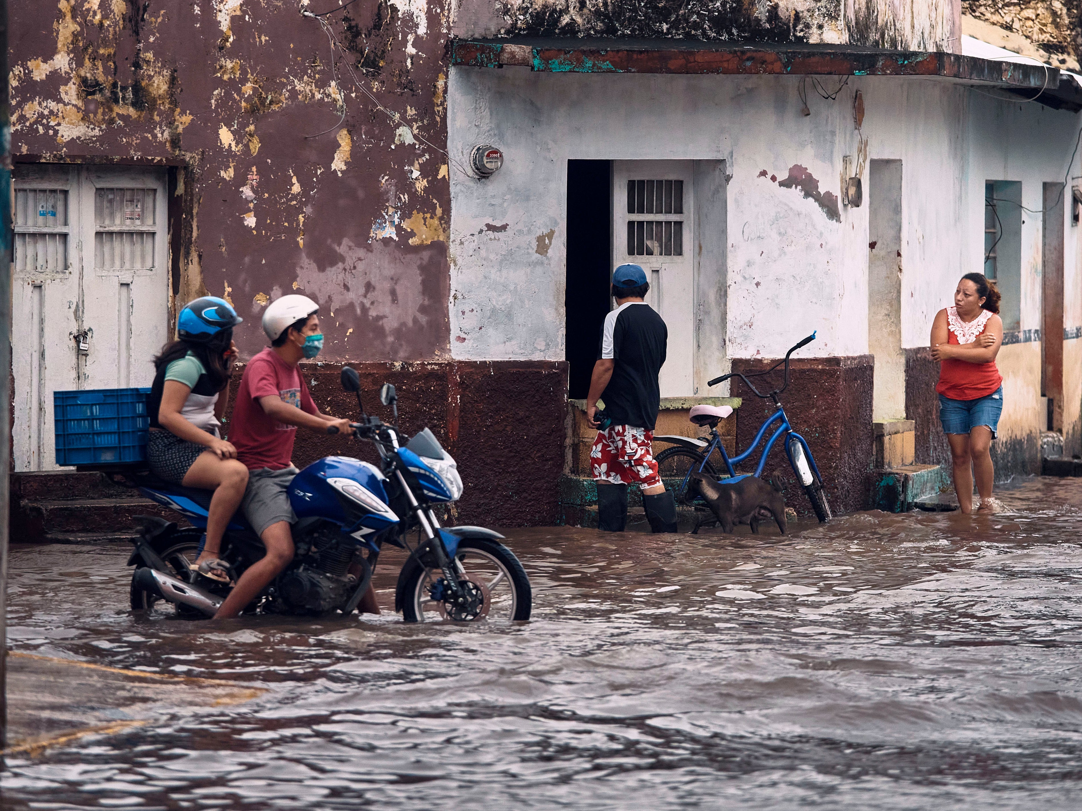
Before it slammed into Mexico’s Yucatan Peninsula on Wednesday and lost some strength, Delta set a record: Going from an unnamed 35mph (56 kph) tropical depression to a huge 140 mph (225 kph) beast.
“In the Atlantic, this is the fastest that a storm has gone from tropical depression to a Category-4 hurricane in 36 hours,” Lillo said.
Storms have more frequently whipped up into major hurricanes in recent decades. Scientists have created a threshold for this dangerous rapid intensification, listed by the National Hurricane Center as a storm increasing at least 35 mph (56 kph) in wind speed in a 24-hour period.
But, as Lillo points out, Delta blasted past that threshold. “It increased by 75mph in 24 hours."
Although it’s a monster storm, Delta is not alone this year in breaching the threshold. Hurricanes Hannah, Laura, Sally and Teddy have also done so. Tropical Storm Gamma did it earlier this week.
When these types of hurricanes happen more regularly, the consequences are potentially lethal.
“If you go to bed and there’s a tropical storm in the Gulf of Mexico and you wake up the next morning with a Category 4 about to make landfall, there’s no time to evacuate. It’s a very worrying trend,” MIT hurricane scientist, Dr Kerry Emanuel, told the Associated Press.
A study in the journal, Nature, from a team at Princeton University last year found that since 1982, the number of rapidly-intensifying storms in the Atlantic nearly doubled.
The researchers’ results suggested “a detectable increase of Atlantic intensification rates with a positive contribution from anthropogenic forcing". In other words, human-driven climate change.
The study also noted there was “a need for more reliable data before detecting a robust trend at the global scale”.
Dr Tom Knutson, research meteorologist at the National Oceanic and Atmospheric Administration’s (NOAA) Geophysical Fluid Dynamics Lab and a co-author of the study, cautioned that studying hurricanes in the Atlantic is a “tricky business”.
He pointed to the fact that reliable evidence only goes back to around 1980, when satellite data began to be used, along with the amount of variability from decade to decade in the Atlantic.
“There is this waxing and waning in the Atlantic,” Dr Knutson told The Independent. “We may be seeing one of these upward jogs since the 1980s but we’re not sure that it’s part of any long-term trend [in hurricanes]."
He added: "Nonetheless, it seems unusual compared to what’s expected from natural variability alone. We also expect that greenhouse warming should lead to some increase in that type of behaviour.”
Dr Jim Kossin, a NOAA climate and hurricane scientist who was also part of the study, told AP that two factors affected the strength of storms.
Ocean warming - caused by bodies of waters absorbing most of the excess heat from greenhouse gas emissions - and the type and direction of winds high up, that can either weaken hurricanes or power them.
In the day-to-day fluctuations of individual storms, the wind issue is important but over the decades that the Princeton team studied, water temperature was a far bigger factor.
“We’ve created so much more heat in the ocean,” Dr Kossin told AP, that rapid strengthening “is what you get when create so much fuel for hurricanes. They’re going to get fat, they’re going to get intense and they’re going to do it quickly.”
Delta formed in the western Caribbean, a typical hotspot in early October where storms have the potential to become strong ones. This year, the sea surface temperatures are also above normal.
“The moisture and heat from the ocean powers the updraft, forming the core of the hurricane," Lillo said. "The stronger the updraft, the stronger those individuals cells wrapping around the center and then it’s positive feedback at that point.
"Above normal ocean temperatures supports the possibility of stronger hurricanes that are able to tap into that heat source and increase the ceiling that a hurricane can strengthen to.”
Lillo noted that while past data has had limitations, "running climate models forward can infer the effect that climate change could have on tropical cyclone frequency and strength".
He said that the sheer number of storms in 2020 speaks to considerable warming in the Atlantic.
"Early on, tropical cyclones were developing at relatively high latitudes. So the difference between an active year, but within a range of normal climatology, and a year like 2020 is the storms in the north Atlantic.
"Warming in the Atlantic, especially at high latitudes, will allow for more storms to form that we weren’t having before."
AP contributed to this report


 Africana55 Radio
