This website uses cookies so that we can provide you with the best user experience possible. Cookie information is stored in your browser and performs functions such as recognising you when you return to our website and helping our team to understand which sections of the website you find most interesting and useful.

Hurricane Milton has rapidly intensified into an "extremely dangerous" category 4 storm as it batters its way towards the US's Gulf Coast, the US National Hurricane Center has said.
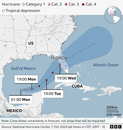
Dangerous winds and storm surges are forecast as the hurricane makes its way towards Florida, where it is expected to make landfall on Wednesday, after passing over Mexico's Yucatan peninsula.
Floridians been told to prepare for the state's largest evacuation effort for years, with Governor Ron DeSantis warning that this latest storm could have "major impacts."
Warnings over Hurricane Milton come just 10 days after Hurricane Helene - the deadliest mainland storm since Katrina in 2005 - tore through the US south-east, killing at least 225 people. Hundreds of others are still missing.
At least 14 of those deaths were in Florida, where 51 of 67 counties are now under emergency warnings as Milton approaches.
By Monday morning Milton was sustaining wind speeds of about 150mph (240km/h), the NHC said.
It is expected to make landfall around Tampa Bay on Wednesday.
Milton is then forecast to continue tracking north-east, cutting across the Florida peninsula as it heads for the Atlantic Ocean.
Ahead of its landfall, torrential rain and flash-flooding can be expected across parts of Florida from Monday, the NHC warned.
It added that life-threatening storm surges and damaging winds along portions of Florida's west coast were possible from late Tuesday or early Wednesday.
Rainfall totals could reach localised highs of 15in (38cm), and coastal areas could see storm surges of of 5-10ft (1.5-3.5m).
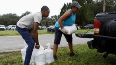
Floridians have already begun preparations for the storm. In the south of the state, residents began filling up sand bags at several distribution sites. Lines of cars waited at petrol station pumps.
 Getty Images
The NHC's dire warnings have been matched by state officials.
Florida Governor DeSantis on Monday warned Floridians the storm is projected to leave the state without weakening and turning into a tropical storm.
"It's going to remain a hurricane at some level all the way through exiting the east coast of Florida," he said.
Floridians have been told by the state's emergency management division head, Kevin Guthrie, to prepare for the "largest evacuation that we have seen most likely since 2017, Hurricane Irma". Dozens of people were killed by Irma that year.
DeSantis, who issued the state's 51 emergency warnings, said preparations were under way to restore power and clear roads, but that people should expect more disruption when Milton hit.
He urged Floridians to have a "preparedness plan", warning of both mandatory and voluntary evacuations. He could not foresee "any scenario where we don't have major impacts", he explained.
Many evacuations are expected in Pinellas County, where at least a dozen people were killed by Helene.
Where and when Milton is expected to hit

The approach of the new hurricane comes as the US government warns that clean-up efforts could take years after Hurricane Helene.
Hundreds of roads in affected areas remain closed, hampering efforts to send aid to hard-hit communities.
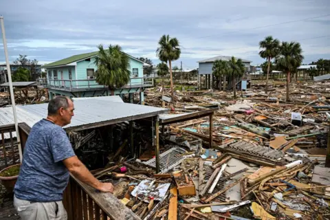
It made landfall in late September as a category-four hurricane - damaging structures, causing flash flooding and knocking out power to millions of homes.
As well as in Florida, deaths were recorded in Georgia, South Carolina, Tennessee and Virginia - and the worst-hit state, North Carolina.
President Joe Biden has ordered another 500 soldiers to be deployed to North Carolina. The troops - who now number 1,500 in all - will work with thousands of government relief workers and National Guard.
Biden has so far approved nearly $140m (£107m) in federal assistance. The use of the money has become the subject of false claims by Donald Trump, the Republican candidate for next month's presidential election, who said relief money had been spent on migrants.
Trump has been accused of "dangerous" misinformation by the head of the US disaster relief agency.
 CHANDAN KHANNA/AFP


 Africana55 Radio

